1

Published December 2011
Contents: ';
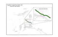
“...Map 1. Point Thomson gas transmission pipeline (0.000 to 58.404); Alaska mainline (0.0 to 1.0...”Report Number(s): FERC docket no. PF09-11-000 USAG-UR-SGREG-000012
First volume of Appendix 2FWebpage to the list of links to all PDF files for Appendix 2F along with links to all volumes in this set
2
3

Published February 4, 2015
Subjects: ';
“...PF-MAP...”Link to the first part of Appendix F
Webpage linking all PDF files for Appendix F of Report no. 2 along with list of all volumes in this Draft resource report
4
Published December 2011
Contents: ';
“...Map 1. Point Thomson gas transmission pipeline ; Alaska mainline (0.000 to 112.680) -- Map 2...”Report Number(s): FERC docket no. PF09-11-000 USAG-UR-SGREG-000002
Link to first volume of Appendix 1OWebpage listing links to all PDF files for Appendix 1O along with links to all volumes in this set
5

Published October 1, 2014
Subjects: ';
“...PF-MAP...”Report Number(s): Docket no. PF14-21-000 USAKE-PT-SRREG-00-0001
Link to first part of Appendix ALink to full text
6

Published December 2011
“...Appendix 1A, U.S. Geological Survey topographic-based route corridor maps...”Report Number(s): FERC docket no. PF09-11-000 USAG-UR-SGREG-000002
Link to this volume.Webpage linking all volumes
7

Published April 2011
“...Appendix 1A, U.S. Geological Survey topographic-based corridor maps...”Report Number(s): USAG-UR-SGREG-000002
Link to this volume.Webpage linking all volumes
8

Published October 1, 2014
Contents: ';
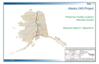
“...[Main report] -- appendix A. Aerial imagery and USGS mapping of preliminary facility locations...”Report Number(s): Docket no. PF14-21-000 USAKE-PT-SRREG-00-0001
Link to main report of No. 1Webpage linking all volumes
9

Published October 1, 2014
Contents: ';
“... and USGS mapping of preliminary facility locations : Corridor sheets (topo and aerial). Point Thomson...”Report Number(s): Docket no. PF14-21-000 USAKE-PT-SRREG-00-0001 USAKE-PT-SRREG-00-0010
Link to report No. 1Webpage listing all volumes
10

11
Published February 4, 2015
Contents: ';
“...Two maps are provided for each corridor section--one topographical sheet and one aerial sheet....”Link to first part of Appendix A of Report no. 1
Webpage linking all PDF files for Appendix A of Report no. 1 along with list of all volumes in this Draft resource report
12

13

14
15

16
17

by White, Bill
Published March 4, 2015
Contents: ';
“... filed preliminary maps to the Federal Energy Regulatory Commission in February 2015 that provide...”Published March 4, 2015
Paper
Bill White's biography.