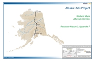
Link to the first part of Appendix F
Webpage linking all PDF files for Appendix F of Report no. 2 along with list of all volumes in this Draft resource report
Link to full text
Webpage linking all volumes in this Draft resource report
Report Number(s): USAG-UR-SGREG-000002
Link to announcement regarding this volumeWebpage linking all volumes
Report Number(s): FERC docket no. PF09-11-000 USAG-UR-SGREG-000002
Link to this volume.Webpage linking all volumes
Report Number(s): USAG-UR-SGREG-000003
Link to announcement regarding this volumeWebpage linking all volumes
Report Number(s): FERC docket no. PF09-11-000 USAG-UR-SGREG-000002
Link to first volume of Appendix 1OWebpage listing links to all PDF files for Appendix 1O along with links to all volumes in this set
Report Number(s): Docket no. PF14-21-000 USAKE-PT-SRREG-00-0001
Link to first part of Appendix ALink to full text
Report Number(s): FERC docket no. PF09-11-000 USAG-UR-SGREG-000002
Link to this volume.Webpage linking all volumes
Report Number(s): Docket no. PF14-21-000 USAKE-PT-SRREG-00-0001
Link to this volumeLink to full text
Report Number(s): USAG-UR-SGREG-000002
Link to this volume.Webpage linking all volumes
Report Number(s): Docket no. PF14-21-000 USAKE-PT-SRREG-00-0001
Link to main report of No. 1Webpage linking all volumes
Report Number(s): Docket no. PF14-21-000 USAKE-PT-SRREG-00-0001 USAI-EX-SRREG-00-0001
Link to main report of No. 1Webpage linking all PDF files for Report no. 1 along with list of all volumes in this Draft resource report
Report Number(s): Docket no. PF14-21-000 USAKE-PT-SRREG-00-0001 USAKE-PT-SRREG-00-0010
Link to report No. 1Webpage listing all volumes
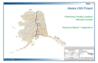
Link to first part of Appendix A of Report no. 1
Webpage linking all PDF files for Appendix A of Report no. 1 along with list of all volumes in this Draft resource report
Report Number(s): USAG-UR-SGREG-000002 (Report no. 1) USAG-UR-SGREG-000003 (Report no. 10)
Link to report No. 1Webpage linking all volumes
Report Number(s): FERC docket no. PF09-11-000 USAG-UR-SGREG-000002 (report 1) USAG-UR-SGREG-000012 (report 2) USAG-UR-SGREG-000013 (report 3) USAG-UR-SGREG-000006 (report 4) USAG-UR-SGREG-000008 (report 5) USAG-UR-SGREG-000009 (report 6) USAG-UR-SGREG-000010 (report 7) USAG-UR-SGREG-000011 (report 8) USAG-UR-SGREG-000007 (report 9) USAG-UR-SGREG-000003 (report 10) USAG-UR-SGREG-000005 (report 11)
Link to volume 1Webpage for full report listing all volumes


