Thermal infrared remote sensing pilot test - mapbook
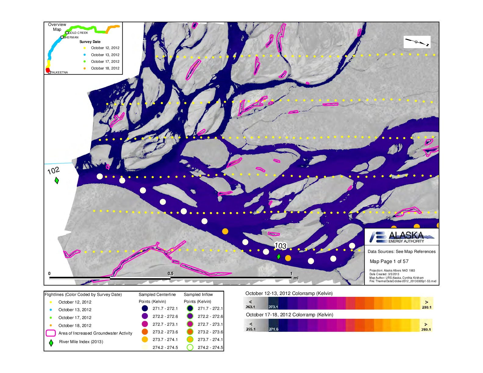
Thermal infrared imaging was conducted along the middle Susitna River reach during flight surveys conducted October 12-13 and 17-18, 2012. This atlas shows the temperature in Kelvin at sampled points, the flightlines, the proposed Watana Reservoir, and areas of increased groundwater activity. It dep...
Saved in:
| Additional Author(s): | Smith, Courtney, |
|---|---|
| Corporate Contributor(s): | URS Corporation-Alaska, Susitna-Watana Hydroelectric Project. Alaska Energy Authority. |
| Publisher: | [Alaska Energy Authority], |
| Report Numbers: | SuWa 38 |
| Series: | Susitna-Watana Hydroelectric Project document ;
no. 38. |
| Subjects: | |
| Online Access: | Link to Full Text |
| Library Holdings: | Print Versions |
| Summary: | Thermal infrared imaging was conducted along the middle Susitna River reach during flight surveys conducted October 12-13 and 17-18, 2012. This atlas shows the temperature in Kelvin at sampled points, the flightlines, the proposed Watana Reservoir, and areas of increased groundwater activity. It depicts the Susitna River between river miles 102 and 191. |
|---|---|
| Physical Description: | 1 atlas (57 p.) : 57 col. maps ; 22 x 28 cm. |
| Notes: | Title from the Susitna-Watana Hydroelectric Project's Document webpage. Maps on p. 1-53 by Cynthia Kirkham; maps on p. 54-57 by Courtney Smith. "Date created: 3/5/2013." ARLIS assigned report number: SuWa 38. The results of this pilot test are described in the report: Thermal infrared remote sensing pilot test. |
| Report Type: | 2012 environmental studies. |
| Related Titles: | Accompanied by (manifestation): Thermal infrared remote sensing pilot test. [Anchorage : Alaska Energy Authority, 2013] |
| Geographic Coordinates: | Scale [ca. 1:12,000] : Albers (W 150°15ʹ--W 148°24ʹ/N 62°52ʹ--N 62°20ʹ). |